

Latest Weather Blog
Tonight's severe weather: What you need to know
Here is what's going on:
The window for severe weather is still present, but slowly closing. Severe weather includes tornadoes, large hail, and strong winds. That being said, a majority of the worst weather is expected to remain toward our north and west.
Residents in northern and central Louisiana experienced impressively strong storms today. The Baton Rouge area is well displaced from the most dangerous of threats, but we are still at significant risk. The National Weather Service has placed our area under a TORNADO WATCH until 2am Monday.

Baton Rouge itself is under an "enhanced" risk for severe weather, which on a scale of 1-5 (5 being the worst) is a 3.
Other parts of the state were under a "high" risk, which is a 5 out of 5. This did not include our area, but this is the most extreme. The National Weather Service is very conservative when it comes to these risks, and a high risk is not seen very often, especially this far south.
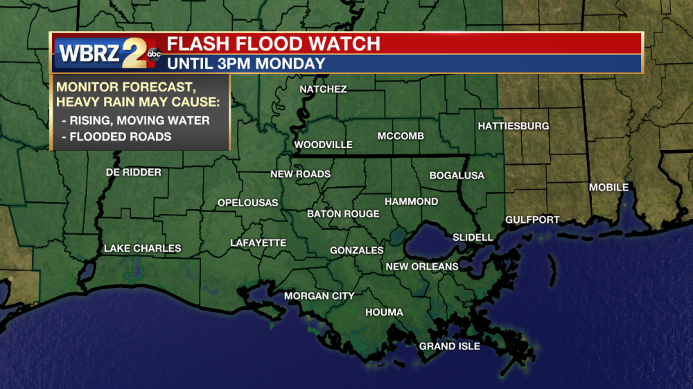
The main line of storms will likely be coming through our area early Monday morning around 4am. By this point, current thinking still is that it will become more of a flooding event as opposed to a severe weather event. For this reason, we are still under a flash flood watch until Monday afternoon. In NO WAY are flood levels expected to reach August 2016 levels.
Trending News
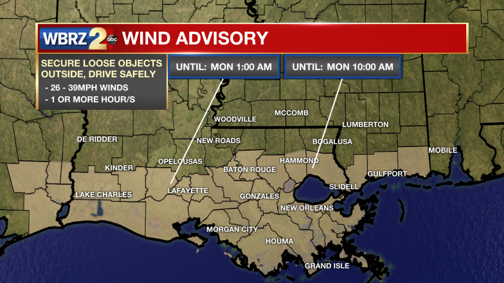
Also to note, parts of the area are under a wind advisory.
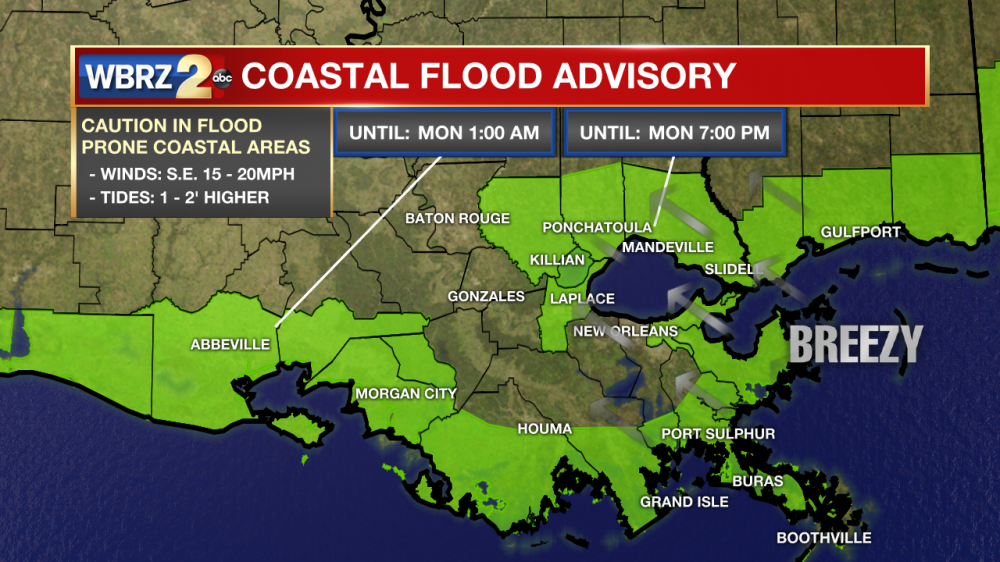
By extension, coastal flood advisories are also present.
What you should do:
Remain vigilant. Stay plugged in on social media and download our weather app. Have something to wake you up like our weather app, or a weather radio. Tonight is a night you may want to leave your sound on in case there is a weather warning for your area. You can guarantee if you receive a notification for a severe thunderstorm or tornado from our app, we will also be streaming live on the app. As always, I will stay with you until the threat is over. Watch me in the comfort of your bed, watch me in the closet should you need to take shelter.
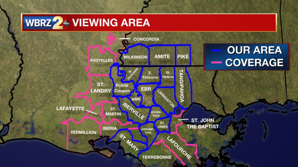
Review the parish/county where you plan on being today. That way, when we point out features on a map, you'll know if we're talking about you or not. We only break into programming for the parishes/counties outline in blue in the photo below.
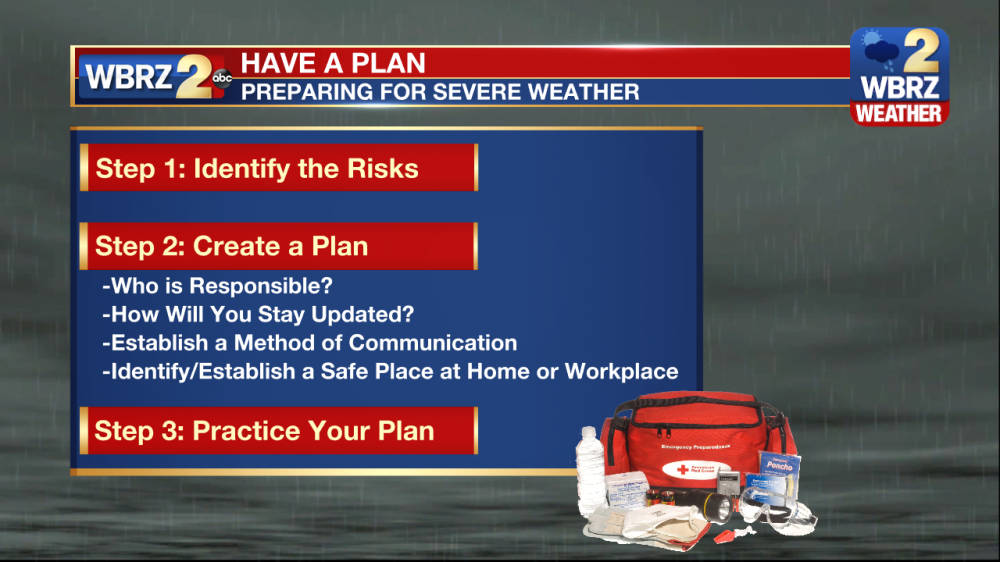
Have a plan ready to go. Again I'll be with you through the night.
On Facebook: Meteorologist Robert Gauthreaux III
On Twitter: @RG3wbrz
En Español: Meteorólogo Roberto Gauthreaux III
In American Sign Langauge: Meteorologist Robert Gauthreaux III - ASL
-RGIII
More News
