

Latest Weather Blog
Sunday morning drizzle possible
THE FORECAST:
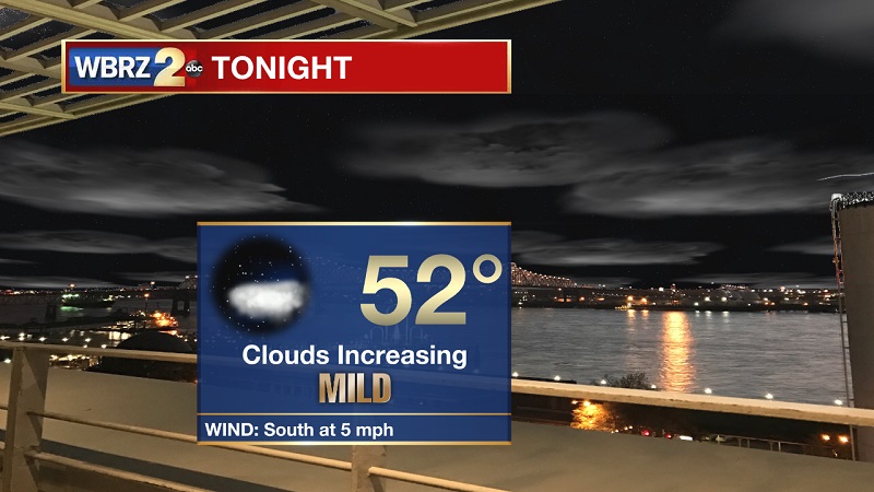
Tonight and Tomorrow: Clouds increasing late tonight, allowing for temperatures to stay in the low 50s overnight. Winds will also be slowing down out of the south into Sunday morning. A relatively dry frontal system is passing through the overnight and early Sunday, with pockets of light showers possible before noon. Clouds will break through the afternoon and into the evening hours, bringing overnight lows back into the mid-40s late Sunday night. Winds will also be shifting late from the southwest to more northerly, which will help to drop highs near average on Christmas Eve.
Up Next: A strong system will be moving in Wednesday and Thursday, with widespread showers and storms into Early Friday. Temperatures will also stay elevated, with highs in the low-to-mid 70s and lows in the mid-to-upper 50s.
THE EXPLANATION:
Trending News
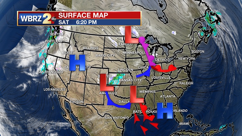
A weak system is continuing to move in through the middle part of the weekend, helping to bring warm air behind the dry warm front onshore from the southwest. The associated low pressure center is tracking to our north, with the cold front traveling through overnight and the morning on Sunday. Mid-level moisture is lacking, so there is not much rainfall that is expected. Pockets of drizzle to light showers will be possible until noon, before breaking clouds bring temperatures near 70° through the early evening. The air behind this cold front will help to bring a return to average temperatures for Christmas Eve, but a strong system will make that short-lived. Highs will be back into the 70s on Tuesday as the ridge shifts east to open the door to a strong system Wednesday and Thursday. This system has a strong Vort Max that will move onshore from the southwest. There seems to also be a strong vertical development component, which will increase as a dry line travels in from Texas on Thursday. This will keep widespread showers and storms in the mix into early Friday. Some of these storms could gain severe status on Thursday, as temperatures will be in the 70s, CAPE values will be near 1000 J/KG, and shear values will be around 35 to 40 knots. These equate to the development of strong and severe storms ahead of the dry line Thursday afternoon and evening. Rainfall amounts are also incurring a wide range between 2-5 inches, which increases from west to east. We will continue to monitor the development of this potential severe weather event through the holidays, as more model specifics in timing and intensity will become better defined. This system is poised to move in after the Christmas holiday, with just a slight chance of showers late Christmas Day.
--Meteorologist Matt Callihan
The WBRZ Weather Team is here for you, on every platform. Your weather updates can be found on News 2, and the WBRZ WX App. on Apple and Android devices. Follow WBRZ Weather on Facebook and Twitter for even more weather updates while you are on the go.
More News
