

Latest Weather Blog
Sun, but another air quality alert
Increasing warmth and humidity is expected through the week.
THE FORECAST:
Today and Tonight: Your Monday will bring another pretty, warm afternoon with mainly blue skies dotted by a couple of low clouds and high temperatures in the upper 80s. Winds will be light and southeasterly through tonight and skies clear out and lows fall into the mid 60s.
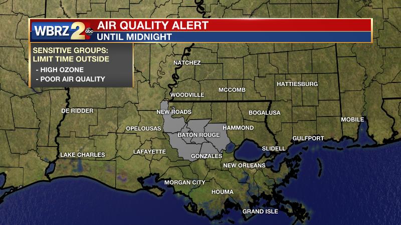
Monday and Tuesday, continued warm temperatures, sunny skies, and light winds will support ozone formation across the central Gulf Coast. As a result, air quality will be reduced in Louisiana on both days, with “unhealthy for sensitive groups” in Baton Rouge on Monday. The elderly, young children, the highly active and those with asthma should limit outdoor exertion for safety.
Trending News
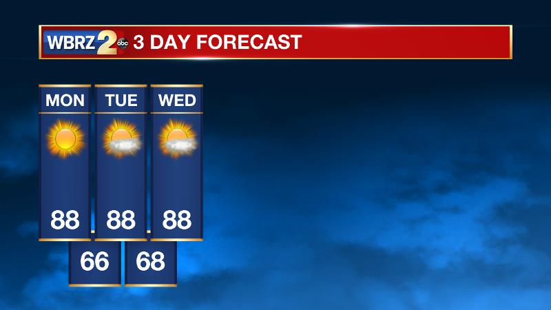
Up Next: An area of high pressure is dominating the southeast and we will see warm and humid air come in as a result. Expect temperatures in the upper 80s each afternoon with plenty of sunshine. Once we approach the middle part of the week, expect low temperatures to eventually reach the low 70s. This means that morning fog will become possible each day as well. As far as rain goes, the forecast stays dry early. It is possible that we could have a pop-up showers developing toward the end of the week, but not organized storm systems are expected until at least Sunday. Thursday through Saturday, forecast area rain coverage should not exceed 20 percent.
THE SCIENCE: Quite tranquil weather expected over the next few days. An upper level ridge of high pressure expands across the entire central half of the United States. Strong subsidence underneath this ridge will suppress any chance for convection. In addition, increasing heights will cause temperatures to moderate slightly. This will bring highs up to and in some cases above climatological averages. The ridge will gradually slide east throughout the week as a broad trough replaces it from the west. Convection developing along the shear axis between those 2 features will begin spreading into the CWA as early as Thursday afternoon. Therefore, summer-like afternoon, isolated thunderstorms are expected into Saturday as the area remains under the same upper level pattern. Forecast models show rain coverage increasing on Sunday as the base of the trough finally swings east across the southern Mississippi Valley.
--Josh
More News
