

Latest Weather Blog
SEVERE T-STORM WATCH until 12pm for Baton Rouge area
The National Weather Service has issued a *SEVERE T-STORM WATCH* for the ENTIRE WBRZ Weather forecast area until 12pm.
***10am UPDATE: the watch has been extended until 3pm***
Locations within the SEVERE T-STORM WATCH area include the parishes of East Baton Rouge, West Baton Rouge, Ascension, Assumption, East Feliciana, Iberville, Livingston, Pointe Coupee St. Helena, St. James, St, Mary, Tangipahoa and West Feliciana in Louisiana and the Counties of Amite, Pike and Wilkinson in Mississippi.
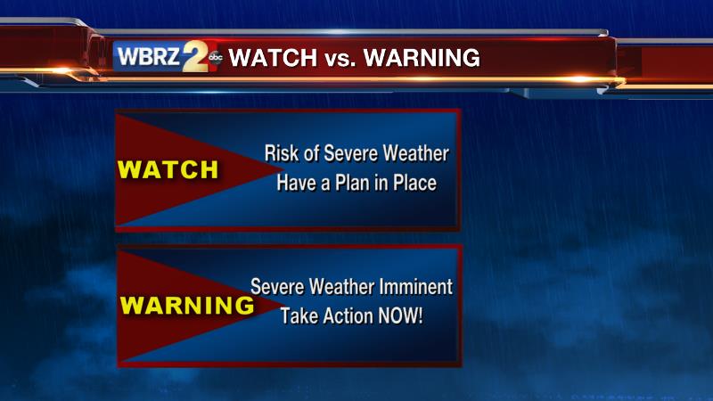
A SEVERE T-STORM WATCH means conditions are favorable for severe thunderstorms in and around the watch area. Be on the lookout for threatening weather conditions and listen for later statements and possible warnings. Severe thunderstorms can and occasionally do produce tornadoes. If a warning is issued, you should seek shelter inside of a sturdy building to protect yourself from the possibility of damaging wind, hail and dangerous lightning.
Trending News
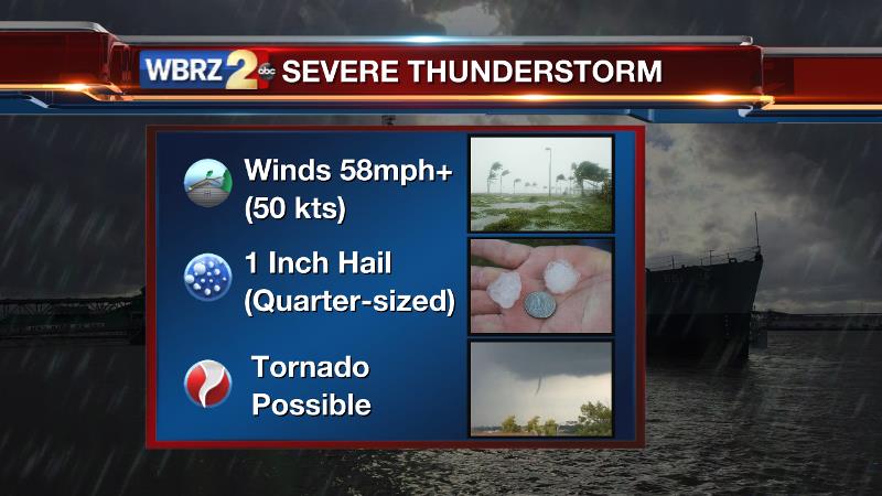
Threats: 1. Damaging Wind | 2. Hail | 3. Isolated Tornado
Coverage and Timing: A line of thunderstorms is expected to cross the area between 10am – 2pm today. Most, if not all, of the forecast area will be affected by the line. However, storms will vary in intensity along the line.
Actions: Be alert to rapid changes in weather, have access to bulletins through the WBRZ WX app., the WBRZ Cable Weather Channel, WBRZ Weather on Facebook and @WBRZweather on Twitter. With both the weather app. and Twitter, you can change your cellular phone settings to allow push notifications and alerts for updates from the WBRZ Weather team. PLEASE share information with those that do not have access to digital media sources. You can share Facebook posts and retweet alerts and make a phone call to those without TV or internet. Any such step could be lifesaving. Secure loose outdoor objects. Move cars under covered areas where possible. Review storm safety plans with friends and family.
Remember: a watch means conditions are favorable for a specific hazard to develop in the future so you should have a readiness plan, a warning means a specific hazard is happening now and you need to take safety precautions immediately.
For a complete analysis, CLICK for today’s weather blog.
More News
