

Latest Weather Blog
Right back to the 70s, not for long
Overall, a quiet stretch of weather is ahead but a temperature turnaround is on the way!
THE FORECAST:
Today through Tomorrow: More sunshine is expected for Tuesday with high temperatures warming quickly into the low 70s. Winds will shift southeast at 5-10mph. Overnight, some clouds will begin to spill into the region and it will be milder with lows stopping near 60 degrees.
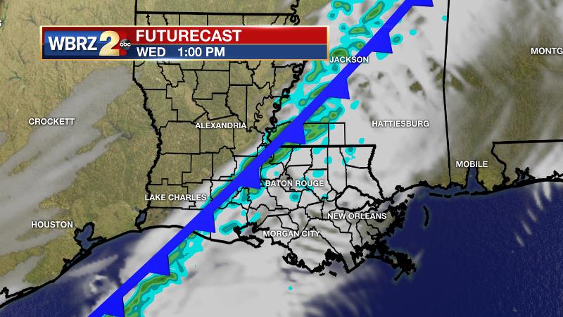
Up Next: A cold front will enter the region on Wednesday. With this system, passing clouds and a few showers are anticipated but no significant rain is expected. Prior to the front, temperatures will top out in the 70s. Cooler air will begin to arrive overnight into Thursday with lows back in the 40s. Chilly air, about 5 degrees below average, will then prevail through the weekend. Highs are forecast to be near 59 degrees, with lows near 40 degrees. No additional rain is on the board until at least next week.
THE SCIENCE: Some weak ridging in the upper levels with surface winds shifting southeasterly will allow thermometers to rebound to above average levels though Wednesday. However, moisture return is not expected to be robust enough for significant shower development as a cold front comes into the region on Wednesday. Passing clouds and about 40 percent rain overage is expected. Strong surface high pressure in the Mountain West with a low over the Atlantic Coast will lead to a steady flow of north winds and cool, dry air through the weekend. Temperatures will trend below average by a few degrees. A deep trough will begin to dig south from the Great Lakes region into the Southeast on Saturday and Sunday. Leading positive vorticity advection will not have enough moisture to develop showers, however some mid to high level clouds may occur. As the trough basin round the Southeast, thermometers may trend even lower for Sunday and Monday—perhaps 5 to 10 degrees below average. Although at this time, no freezes are expected.
Trending News
--Josh
More News
